|
(*) Actualmente esta etapa tiene una incidencia en el trazado. MÁS INFORMACIÓN.
|
Distancia aprox: 15 km.
|
Tiempo (ida): 4 h
|
Dificultad según el método MIDE
|
 |
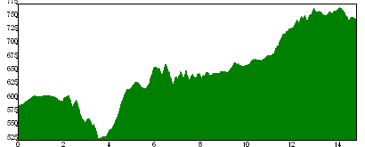
Perfil de la etapa

|
|
|
|
|
|
|
|
|
|
|
|
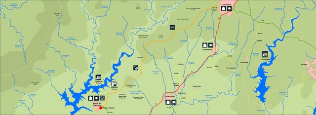
Etapa 28: La Carolina – Santa Elena
|

|
La última etapa del GR-48 es fácil de realizar, pudiendo pararnos para descansar a medio camino en el Área Recreativa La Aliseda, habilitada con mesas, bancos y fuentes. Nos encontramos en las últimas estribaciones orientales del macizo de Sierra Morena, en la misma puerta de entrada a Andalucía. Tierra de frontera y de minería, en torno a la cual se han librado importantes batallas que cambiaron el curso de la Historia de España. La etapa finaliza en el entorno del Parque Natural de Despeñaperros.
|
|
|
|
|
 |
The last stage of the long-distance track GR-48 is easy to carry out, we will have a stop half way to have a break at the Picnic Area “La Aliseda”, fitted out with tables, benches and some fountains. We are in the last oriental spots of the mountains mass of Sierra Morena, right at the Andalusia gate. Border and mining land, over which many important battles were fought which changed the course of the Spanish history. The stage finishes in the surroundings of the Natural Park of Despeñaperros.
|
|
|
|
|
|

