|
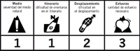
Distancia aprox: 21,4 km.
|
Tiempo (ida): 5 h
|
Ciclabilidad: Excepto subida y bajada al Cerro Torreárboles
|
Dificultad según el método MIDE
|
 |
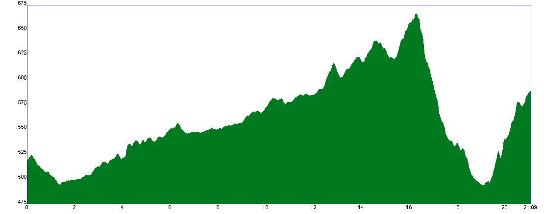
Perfil de la etapa
|
|
|
|
|
|
|
|
|
|
|
|
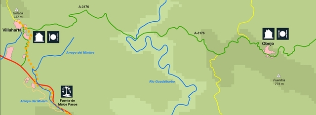
Etapa 18: Cerro Muriano – Villaharta
|

|
En este trazado de sur a norte, la huella histórica se refleja tanto en las vías de comunicación por las que transitaremos (calzadas romanas, Cañada Real Soriana o Camino Mozárabe a Santiago) como en el Castillo del Vacar o las fuentes agrias de Villaharta, cuyas aguas han sido muy usadas debido a sus propiedades medicinales. El paisaje más común que veremos será el de las extensas dehesas de encina y el variado matorral mediterráneo.
|
|
|
|
|
 |
During this route from south to north, the historical trace is reflected on communication routes we will walk through (old roman paved roads, Real Soriana route or Mozarabic path to Santiago) as is the case of Vacar’s castle or Villaharta “agrias” fountains, whose waters have been very used because of its medicinal properties. The most typical landscape we will see during this route will be the vast meadows with holm oaks and the varied Mediterranean bushes.
|
|
|
|
|
|